Thursday 23 September 2010

PHOTO ALBUM

Picos de Europa

Fife Coastal Path 1

Fife Coastal Path 2

Fife Coastal Path 3

Margaret

Suzy's Wedding
 

Nepal and the Himalayas


Wednesday 22 September 2010

The Fife Coastal Path

Day 1

The weather wasn’t very good this morning very cloudy with rain forecasted but we were going off anyway. We took the M8 towards Edinburgh and had the expected delays in Glasgow at the Kingston Bridge, but otherwise it was a carefree run. Before reaching Edinburgh I turned off for the Forth Road Bridge and crossed over the River Forth and on the other side we found the park and ride bus terminal that was under the Forth rail bridge and stopped there.

The intention was to walk a loop down to North Queensferry where the Fife Coastal Path began and follow the route which then came through the park and ride where we were parked. Tomorrow we would take the bus from the caravan park, where we were heading tonight, back here to the park and ride for the next stage..

It was about a mile from the car park down to the walk start at North Queensferry and we got magnificent views of both Forth bridges. At North Queensferry it was the usual problem to find the start of a walk but this time we were lucky and it only took a few minutes searching and we were on our way.

 It was just 1½ miles back to the van along a tarred track and back streets that ran beside the River Forth before turning up an inlet at the top of which was the car park. The first part was nice with more stunning views of the bridges but as we turned to the inlet it was an industrial area with a quarry, scrap yard and Tunnel cement plant. The main thing was to get this loop done and tomorrow we would have a straight run into the route proper.

Once back at the van we were soon on our way again heading for our camp site for the night. It was about an hours drive on ‘A’ roads that were busy through the towns of Inverkeithing, Kirkcaldy, Leven and Lundin Links places we will walk through over the next couple of days. Just before Upper Largo we turned at a lane and up a steep hill for ½ mile to the caravan park, Woodland Gardens. The site was small but very nice and we got parked on a hard stand beside a hedge in a grassy corner.

Day 2

We walked down to Lundin Links and the bus arrived on time at 9:04 and it went via Kirkcaldy to Edinburgh. At Kirkcaldy we noted where the bus station was as that was where we hoped to walk to today and catch the bus back from to the caravan park. It was another 30 minutes from Kirkcaldy to the park and ride under the Forth Bridge where we parked yesterday.

At 10:15 we set off on our first real day of the Fife Coastal Path. The first part was up the road and through the centre of Inverkeithing. At the Mercat Cross which required photographs the signpost directed us down to a firm tarred path that ran along the shore side to Dalgety Bay. All along this route were magnificent houses obviously very expensive but handy if you work in Edinburgh which is only 30 minutes away by car. Another tremendous view we got was of the Forth Bridge which we saw more and more of as we rounded the inlet and on to the side of the Firth of Forth.

From Dalgety Bay it was 3 miles of pleasant walking near the shore and at other times through nice wooded areas. One of features on the route was Donibristle House built in the 12th century it was the residence of the Abbot of Inchcolm and later minor Scottish royalty. It had a chequered history and many fires over the years, it is now converted into luxury flats and as our guide book says ‘we hope they have fire insurance’. Another stopping and camera opportunity was the ruin of St Bridget’s Chapel, a 12th century church that was in use until well after the Reformation. It was now a ruin with no roof but its main features were still obvious.

It was another 2 miles through some wooded country to the town of Aberdour where it was a walk along the main street before cutting down to the waterside again. There were plenty of benches overlooking the Firth and we sat down and had lunch, There was a plaque near where we sat depicting the view over the Forth, it point out Leith docks, Arthur’s Seat and Edinburgh Castle amongst other things and it was a thrill to be able to identify them from here.

After leaving Aberdour the route should have taken us over a rocky cliff, Hawkcraig, but we took a wrong turning and ended up at a dead end below the crag. We made our way round the rocky beach and met a few climbers who were scaling the rock face. Hawkcraig is a favourite spot for climbers. One of them told Moira that we should make our way round the rocks to the lighthouse and pick up our trail there. At the lighthouse the route led round to a lovely beach, Silversands Bay, it was very busy and people were even in swimming, it was a nice day but not that warm. The Scots are a hardy race. From Silversands Bay it was a pleasant walk along a path close to the railway. It was a busy line with trains thundering past every 5 minutes. At the end of the path we came into Burntisland and from there to Kinghorn was the worst section of today’s walk. It ran along the side of the busy A921 for 3 miles, fortunately there was a good pavement all the way. It was a steady climb up to a point overlooking Kinghorn harbour but the scenery was spoiled by a holiday park with hundreds of drab green static caravans covering the hillside. At Kinghorn we were back on to a path along the coast just 3 miles from Kirkcaldy. At the end of the path just before the town we got a bonus with the sight of a colony of seals on a strip of rocks just off the shore. We were attracted first of all by the grunting then a man pointed them out to us. Further over there were many sea birds and a large number of black and white ones swimming about. Later from an info board we could identify these as Eider ducks.

Into Kirkcaldy it was a casual stroll along the esplanade to the point where we cut up to the bus station. We were tired and happy to be finished it had been a long day and 17 miles in our legs. It was 5:00 when we got to the bus station and had 40 minutes to wait for the bus. It didn’t go to St Andrews but finished at Leven where we changed to a local bus. This ended up quite convenient as it went down to Lower Largo then up to the main road again just at the road up to the caravan park. It was a struggle up the hill but we made it and were back before 7:00, a long day!


Day 3

Out again this morning at 8:30 and we walked down to the bus stop at Lundin Links and caught the same bus as yesterday. Today it was just to Kirkcaldy and we got off at the bus station and walked down to the esplanade to pick up the coastal path there.

At the end of the esplanade we had a section through the streets past the remains of the Nairn linoleum factory the first in the industry synonymous with Kirkcaldy. Later along the road there was a plaque telling us that in 1847 Michael Nairn established the Scottish floor cloth Manufactory. Soon after this we came to Ravenscraig Park and cut down the paths to the shore. At the bottom we had good views of Ravenscraig Castle that we had glimpses of from the road. Also at the turning there was an old dovecot and good views back at Kirkcaldy.
        
It was now a pleasant walk along a good path overlooking the Firth to Dysart. The path went through a tunnel cut through the rock to emerge at Dysart harbour, a pretty little shelter for some attractive yachts and other river craft From Dysart it was a path along the Firth side all the way to West Wemyss, it was an enjoyable stroll and went past the walls of an old castle that was now gardens and once through West Wemyss there was another castle on the hill above the path, Wemyss Castle. Further on there was a bit of a climb up to the top of a cliff as the route went past a disused colliery, the Michael pit that was closed in 1967 after a fire that claimed five lives. The winding gear now stands as a memorial. When we reached East Wemyss the trail ran along a promenade and we found a bench to sit and have our lunch.

On the go again it was an excellent track on a disused railway line. It passed some caves and another ruined castle, MacDuff Castle before reaching Buckhaven. At this point it was on the roads again for 2 miles some on the busy A931 through Methil to Leven where we had changed buses yesterday. As we cut down to the esplanade the road went past an energy company, there were rows of structures that looked like platforms but too small for oil drilling. I thought they might be supports for off shore wind mills.

The Leven prom lasted for about ½ mile then we had the choice of going along the beach or a path beside the golf course, Lundin Links. As our legs were tired we thought the sand would be heavy so we took the golf course route. It was enjoyable and easy going we just had to watch out for stray golf balls from the many people playing. At the club house a short track took to the road leading into Lower Largo. At the Crusoe Hotel we turned up the hill to the main road. The Crusoe hotel is named for Robinson Crusoe who was based on the adventures of Alexander Selkirk who was born in Lower Largo. The road up the hill went under a viaduct of a disused railway, below there was a lovely little group of houses around the harbour.

It was about ½ mile up the hill to the main road then the further ½ mile up the hill to the caravan site. It was struggle these hills at the end of the long walk, we had done 13miles today.


Day 4


No need for a bus to the start of our walk this morning, we left at our normal time 8:30 and down the hills to Lower Largo. As we walked through the town there were white painted footprints to depict the ones left by ‘man Friday’ in the Robinson Crusoe’ story. Further on there was a sculpture supposedly depicting ‘Friday’ and over Alexander Selkirk’s house a statue wrongly named as Crusoe.

Leaving Lower Largo the route went up to an old railway, the one that once crossed the viaduct at Largo harbour. It was closed in the sixties by Beeching. The route was now cutoff from views of the coast and sea by large bushes and shrubs, but it was an easy walk. The weather was cloudy and cool but the clouds slowly burnt off during the morning and we had bright blue skies though it was never hot a chilly breeze had us keeping our tops on.

The track followed the old railway for about a mile then there was a split. We could either go along the beach or at high tide an alternative path over the dunes. Although it was still low tide we didn’t fancy walking on the sand so headed over the dunes which was fairly firm underfoot. At the end of the dunes section we came to Cocklemill Burn, this used to be a ‘paddle’ according to the guide book but two bridges had been erected and made life easier. Once over the bridges the route left the shore and went through a holiday park with lots of static caravans but back towards the coast again we came to Kincraig Hill, there was supposed to be a route scrambling over the rocks assisted by chains. I wanted to go that way but Moira was reluctant, anyway we missed the turn off and ended up taking the alternative over the top of the hill. Once at the top we could see the route below with the chains to make the climbs and scrambling easier. At the top of the hill there were gun emplacements and an observation post from the war. Also there was a communications mast and trig point, 63 metres. From this point we got wondrous views back to Leven and Largo and onwards to Elie, below there were golden sands with little waves , no surfing breakers here.

At the bottom of the other side of the hill we met up with the rock route again and this time we took the beach way instead of the dunes. The sand was firmly packed and it was easy going, at the end of the beach we cut up through a church graveyard and on to the roads into Earlsferry and Elie. At the end of the village we cut down to the harbour and on along more streets to a path that took us up to a picnic area next to a lighthouse at Ruby Bay. We stopped here for our lunch, sandwiches and water.

From our stopping point it was a good firm path close to the beach all the way to St Monans. On the way there were the ruins of two castles. The first Ardross Castle didn’t look much more than the remains of a large house though it did have at the corners structures that could have been turrets, further on Newark Castle was more impressive and had a commanding position at a point on the top of the cliff at a promontory. From St Monans to Pittenweem we went passed a windmill that was originally used to pump sea water to pans and evaporated using local coal to produce the sea salt. The windmill is still in good condition but of the series of buildings with the boilers and pans only the foundations remain. There was a number of boards describing the process and drawings of how the area once looked. It was a good path in to Pittenweem and from there it was another mile to Anstruther and the route skirted around yet another golf course.

Once in Anstruther we quickly made our way to the harbour where the bus terminus was and we had half an hour to wait for the express bus and found out that it stopped at the junction up to the caravan site but it was the usual struggle up the hill.


Day 5

This morning we went to Upper Largo for the bus., a footpath beside the site was signposted as a route to Upper Largo so we took that. It was a pleasant grassy track through fields of bright yellow rape growing and came out at cemetery at the top of the village; a short walk down a hill brought us to the bus stop. It was a charming small country village with a couple of shops, the local post office cum general store and the church with a tall spire. We had about 20 minutes to wait for the bus and then another 30 to take us to Anstruther Harbour where we finished yesterday.

Leaving Anstruther was by the back streets witcars parked half over the pavement making it difficult to walk, that’s what traffic wardens should put a stop to!! There was another lovely little harbour at Cellardyke to the east of Anstruther then through another caravan park with lots of static vans before we were out in the country and on a rough path along the sea shore. Just at the start of the track on the landward side there was a huge pig farm. It was free range and was all in the open with little houses for all the pig families. There were water troughs and feeding chutes scattered around and some the pigs had lots of little piglets running after them. We spent quite a time there watching and photographing. It was 3 miles to Crail and the Caiplie Caves were the next photo stop, a series of strangely shaped rocks one with a hole through it at the top and large caves at the bottom.The view out to sea wasn’t very good today there was a heat haze and we could just make out the Isle of May but little else. There were some ruined houses on the trail just before we got a climb that took us to a point overlooking Crail harbour. It was a lovely view down to the harbour with lots of little craft anchored there and the hillside festooned with brilliant red and purple wild flowers. With the bright sun in a clear blue sky it was the perfect summer’s day. 

From our view point the road dropped down to the harbour then up a hill on the other side. A notice told us that the rare sea bird the Fulmar nested on these cliffs and I spotted two that were sitting on nests further down the rock face. It took some twisting and bending over the guard rails but I did manage to get some pictures of them. The road dropped down again to the sea front and a tarred path took us to yet another holiday park. This one was enormous with rows and rows of statics and holiday homes like old prefabs; it went for nearly a mile.

Another mile after the holiday park took us along a rocky coast to Fife Ness where the Firth of Forth finishes and we were now beside the North Sea. There was a coastguard station at the point and a few houses. We stopped for lunch, nice chicken sandwiches, sitting on the rocks beside an old ruined harbour that the coastguards used at one time to combat smuggling. From now on there seemed to be one links golf course after the other along the coast. The path ran beside the fairways at times and we had to avoid a few flying golf balls, and at other times we were forced on to the beach and rocks to find our way along the coast. Today was a short day and we had only 4 miles from our lunch stop at Fife Ness to our finish at Kingsbarn, where we caught the bus. It was a long trip now back to the site as we get further and further away, it took an hour. We got off at Upper Largo and took the route we came this morning, the hill up to the track through the fields wasn’t as steep as our normal climb..


Day 6

We walked down the hill to the bus stop at the top of the road from Lower Largo and caught the 95 bus. This local bus goes round the houses and through all the villages and we didn’t get to Kingsbarns for over an hour, so it was a late start when we reached the trail again ½ mile down the lane.

Things were looking brighter as we began, the clouds breaking up and some blue sky appearing and it was fairly warm. Lots of people were golfing as the first part of the trail took us beside the fairway and we were on the look-out for wildly hit golf balls. Soon we came to a sign as we left the links that it was 7½ miles to St Andrews. The going was rough where parts of the path had been eroded or washed away in storms and we had to walk on the beach or scramble over rocks. Fortunately the tide wasn’t high or we would have been cut off in places where signs warned us to wait until high tides receded before continuing. The area was otherwise remote and only ruined houses popped up every now and then along the route, One good thing about the clear weather today was that the views out to sea were better and the Isle of May nice and clear.

The path turned inland to the village Borehills then headed back to the coast and here the cliffs were higher. The path undulated between the cliff top and the beach and now on the coast again we got our first glimpse of St Andrews in the distance but as we rounded points and promontories it still didn’t seem to get any closer.

With still two miles still to go to this golfing capital we stopped for lunch at a solitary bench on the beach for lunch. There was a bin there but it was overflowing with rubbish scattered all around. It’s not much use supplying bins in remote places if nobody is going to come and empty them. After lunch there were more ups and downs on narrow paths and scrambles on the beach. An interesting formation on the beach, Rock and Spindle, held us up slightly for photographs before the path levelled out along the cliff tops beside yet another golf course then yet another caravan park before entering St Andrews.


The route through St Andrews followed all the tourist attractions, the Cathedral, St Rule’s Tower, St Andrews Castle and the Old Course. At the Old Course lots of work was going on for the Open Championship beginning here in July. Many of the grandstands had been erected but still plenty was going on. People were still playing on the course, many tourist judging by the times we saw them stop on their round to take photographs of famous parts of the course. I was also busy with my camera and got some good shots of all the attractions.

Leaving the famous golf course our trail picked up the Kingdom of Fife cycle track and headed up the side of the river Eden to a crossing at Guardbridge about 4 miles on. There we got a bus back to St. Andrews and after a ¾ hour wait a connection back to Upper Largo.
.

Day 7

It was the express bus to St Andrews and it only took an hour. When we arrived there was a bus just about to leave for Dundee and we jumped on, in another 15 minutes we were at Guardbridge and starting the last leg of the Coastal Path. There were blue patches beginning to appear in the sky but the wind was strong and cold.

An old narrow foot bridge parallel to the road bridge took us over the river Eden and picked up the Kingdom of Fife cycle route which we followed for most of the day. The tarred track and at times the pavement went round the houses of Guardbridge and then the Air Force base at Leuchers before heading into the country. During this period jets were continuously landing and taking off at the base and the noise was thunderous, but a magnificent sight. At the gate leading into the countryside a sign said ‘keep to the track until the next marker’; we didn’t see another way mark. We came to a farm and the map showed that the route should go straight on but straight meant into the farm and the track went to the left. Moira asked a woman who came along walking her dog but she was clueless, so we just followed the track as instructed at the last gate. It was obviously not right as it continued in the wrong direction, there were no signs and when we eventually reached a minor road a notice pointing back said ‘Coastal Path 1 Mile’. I didn’t fancy walking back a mile to look for a route at the farm again and stood wondering which direction to take on this road. A post office van came down the road and I flagged him down, a postman should know where we were. He did and said that we could continue down the road and we turn right shortly and head to Kinshaldy Beach, though he said we would be better to go back along the track and find the Coastal Path. Kinshaldy Beach was on our map and the Path went there so we kept to the road, no going back to get lost again.

At the right turn on the road a sign post showed ‘Parking for Coastal Path 2 Miles’, which was just before the beach, we were definitely back on track. Another mile further the route we should have taken joined the road; Moira reckoned we had taken a 2 mile detour. The road was now entering a wooded area, the Tentsmuir Forest, and headed to a car park and picnic area just before the beach, we were on the coast again. We found a table in among the trees sheltered from the cold wind that was still blowing and had our lunch, it was a pleasant spot and a number of people were about who had mostly come by car.

It was only a ten minute break for lunch and we were on our way again. There were plenty of signs on the route now, it was the Kingdom of Fife and also the’1’ cycle routes, a local marked walk and the Coastal Path. The track went through the trees of the Tentsmuir Forest for about 5 miles and wasn’t very interesting but for the chorus of whistles from the birds in the trees. Shortly we came to an old brick structure that had been an ice house for freezing salmon caught in the River Tay. It was now unused except for the bats that had taken over as a home, but we couldn’t see any through the slot in the door, it was too dark inside. The beach wasn’t far away just 25 metres through the trees, we could see it at the ice house stop and there was a big surf breaking on the North Sea beach helped by the strong wind. At Tentsmuir Point there was a view point; this was where the Firth of Tay met the North Sea and the coast turned to follow the River Tay. Across the Firth we could se the town of Broughty Ferry and further up the out skirts of Dundee, but no sign yet of the Tay Bridge.
            
The path went into the forest again and we only caught occasional glimpses of the sea at the foot of small side tracks that led down to the beach. The weather had now brightened up with plenty of blue sky, the wind had dropped. At the end of the forest we entered the outskirts and houses of Tayport and the road made its way down to the esplanade that ran along the side of the Firth. Soon we were through Tayport and on a tarred cycle path probably an old railway track that went through more trees. As we came out of the trees and a mile to go we got our first sight of the Tay Bridge.It wasn’t far away but tantalisingly didn’t seem to get any closer. I got some good photographs of the bridge but it isn’t as attractive as the Forth bridges. At the end of Coastal Path it was disappointing, there was no welcoming signs saying such things as ‘Congratulations, you have made it’. All we had to do was find the place to get the bus back. It took a while to find the correct bus stop but once there had only 5 minutes to wait for the bus. It took 30 minutes to get to St Andrews then catch our connection to Upper Largo.  


Tuesday 21 September 2010

The Comrades Marathon


The crowd are on their feet, they are lining the barriers along the finishing straight, the noise is tremendous. The count down has started to the cut off time of 11 hours. The race official with his back to the finishers prepares to fire the gun to end a long long day. He does not want to face the hundreds now crossing the line and be swayed by the disappointed faces of those lacking the energy and stamina to sprint the last few metres and beat his trigger finger. Still they run walk crawl some are carried over by strangers they have only met that day but who have turned out to be true Comrades, this is the spirit of one of the world’s truly great races.
June 16th, the date of the Comrades Marathon is when the majority of road runners in South Africa plan for their fitness to peak after about 20 weeks of hard training. It is a monstrous journey between Pietermaritzburg and Durban, the ‘down’ run, one year and the opposite direction Durban to Pietermaritzburg, the ‘up’ run, the next year. The distance is 90kilometres approximately, the ‘down’ being about 3kilometres longer than the ‘up’.
The race is famous for its hills and many of their names add to the folklore that surrounds the event. At half way lies Drummond in the Valley of  a Thousand Hills and on either side of this hollow are two ‘mountains’ Inchanga and Botha’s Hill which have to be climbed no matter in which direction the race is run. Others that have brought even the finest runners to a plodding walk are Fields’ Hill, Cowies’ Hill, and Polly Shorts. The latter, Polly Shorts, is probably the most dreaded on the ‘up’ run. It is about 3kilometres long and doesn’t look much if you drive over the course beforehand but with about 80kilometres already in your legs it is like tackling Everest.

The race was started in the early 1920’s by a few army comrades from the First World War. From these humble beginnings of a handful of runners the race continued with small fields until the running boom of the 70’s and 80’s made it into an icon from top athletes to keep-fit joggers to achieve. Entries now average 12000 and a field in excess of 20000 turned out for the Millennium event. After the gun goes to set the race off it can take 20 minutes for all the runners to pass under start banner. Because of the vast numbers you are never alone on the route and have dozens of others at your side all the way, new friends are made as runners talk one another through bad patches. Not only are runners plentiful but on the sides of the road are thousands of supporters and well wishers. These people spend the whole day on the route shouting, cheering and run beside you to give encouragement. Others sit at their picnic tables drinking their wine and tending the barbecue, watching not only the race in front of them but the battle for the lead on their portable TV sets. These friendly locals willingly supply refreshments to runners not readily available at the feed stations, like a can of beer, a steak roll etc. believing this will get you to the finish.
The organisation of the race is first class with the Committee starting on the following year’s event after analysing problems from the one just finished. This involves the route planning, entries, negotiations with sponsors, police, traffic authorities and many others. All the runner sees is a smooth registration system and exhibition for a week before the race which includes photographic memorabilia in the Comrades Experience and hundreds of suppliers of equipment from shoes to energy supplements that have set up stalls. Once the race starts the route is marked every kilometre so you always know where you are. Water points and feed stations are every 3kilometres during the first half and about every kilometre towards the end. The stations become so long that they seem to run into one another making the last 30kilometres or so one long water point. The feed stations are not just water but coke, energade, chocolate, sweets, baked potatoes, bananas etc. Yes it is really well organised.
There is a qualification requirement for entry; you must run a standard marathon in under 4 hours 30 minutes. Your starting position depends on your marathon time, the faster your time the nearer the front you start. At the finish the first 10 across the line get gold medals, for finishing under 7hours 30 minutes it’s a silver medal, a Bill Rowan medal (named after the winner of the first Comrades) is for sub 9hours and for the bulk of the runners, those finishing between 9hours and 11 hours the achievement of a bronze. There has been talk of increasing the cut off time to 12 hours with a fifth type medal and this could be happening this year.

Training schemes and plans for Comrades are as many as there are runners. Everyone has their own methods of attaining their goal. One thing is generally accepted, you must get lots of mileage in your legs between January and June to build up endurance. The South African running calendar is full of long races 32, 42, 50 and 56 kilometre events that runners use as long slow distance (LSD) training runs. Most would do at least three standard marathons and an ultra marathon in their build up for the race. Managing these long runs would be difficult for people in Australia to on their own. It would better if three or four friends planning to do Comrades got together and so do the long training as a group. To have a comfortable Comrades a training mileage for the five month period of over 1500kilometres is necessary but over 2000kilometres except for elite athletes could result in over training and injuries. LSD will be sufficient for anyone with a goal just to finish comfortably with a bronze medal, for those with higher ambitions, gold or silver, speed work (track, fartlek, and time trials), hill repetitions, gym work and cross training should be incorporated in their work outs.
Strangely most people prefer the ‘up’ run. One reason being that in the other direction  some of the long down hills cause severe strain on the leg joints and calf muscles, especially the long drop down Fields’ Hill into Pinetown and that makes  the final 20kilometres very painful. Another reason is the more convenient start in Durban, which being a large holiday resort has a plentiful supply of hotels within walking distance of the start. The opposite is the case with Pietermaritzburg where accommodation is limited. Many prefer to stay in Durban and travel up to the start but with the off at 6am you have to leave Durban about 4am, not the best preparation for an ultra marathon
Finally the most difficult part is mental preparation. You will be filled with doubts, “Have I done enough mileage” “ Can I manage the distance” “90kilometres is a long way” and many more. For the week prior to the race while tapering your training you will plague family and friends with imaginary symptoms of colds and flu, aches and pains of supposed injuries. All this will disappear when the gun fires and you embark on the great adventure of the Comrades Marathon. I guarantee you will enjoy it.

Jim Sutherland

Further information on the race can be obtained from the official web site
or contact me at my e-mail address
suzmaruk@yahoo.co.uk          


Hadrian's Wall Path


We planned to walk the Hadrian’s Wall long distance trail from Wallsend near Newcastle to Bowness on the Solway Firth. Previously when we did these long walks we backpacked stating either in hostels or camping, but now we were a bit old for that and had other plans. Having got into ‘motorhoming’ a few years ago the scheme was to stay at a caravan site approximately half way along the route and use our motorhome and the local bus service. The idea was to park the motorhome where we would if possible finish our day’s stretch of the walk and travel by bus to the day’s start point. We found it preferable to have the ‘home at the end of the day’s walk and know that we were finished and not the other way round and depending on catching a bus at the end of a hard walk then finding we were either late or it had been cancelled. This wasn’t always practical and convenient parking of the ‘home also had to be considered.

The caravan site we decided on was the Haltwhistle Camping and Caravan site on a hill above the town at Burnfoot Park Village, Tel. No 01434 320106. There are 50 pitches some on hard stands others on grass but all level. The site had all the facilities and although busy was peaceful and quiet. Our motorhome is a 2009 Ace Airstream and gave us a very comfortable ride from Clydeside in Scotland down to Haltwhistle.

We intended to walk on average 15 miles each day and this would take 6 days. We broke down the route on the basis of roughly this distance, convenience of parking and frequency of buses as follows
Day1     Wallsend                      to  Heddon-on-the-Wall      15 miles
Day2     Heddon-on-the-Wall    to  Chollerford                     15 miles
Day3     Chollerford                   to  Milecastle                       14 miles
Day4     Milecastle                     to  Banks                            14 miles
Day5     Banks                           to  Carlisle                          15 miles
Day6     Carlisle                         to Bowness-on-Solway       15 miles         


Monday

The first section of the Hadrian’s Wall Path was easy along nice level tarred footpaths beside the banks of the River Tyne, except for the last 2 miles or so which took us up a long hill to our destination for the day, Heddon-on-the-Wall.

 We repacked the van after breakfast and drove to Heddon, it was just a village and I parked in a side street in a residential area. We caught a bus within 5 minutes and it took about half an hour to get into the centre of Newcastle and cost £5.80. It was another £4.40 on the Metro which took us to Wallsend. The walk began at Segedunum the fort at the end of the Wall now a museum and visitor’s centre. They issued ‘passports’ which we got it stamped there and at various point along the route. This qualifies you for a t-shirt.

From Segedunun the signposts directed us down to what looked like an old railway and the now tarred path made its way through a wooded area and eventually down to the edge of the River Tyne. There was a strong chemical smell and a warning sign told about the dangers of going on to the shore due to hazardous chemicals from a now defunct tar works. The smell did resemble tar and the ‘beach’ was black with it.

We stopped for lunch in the centre of Newcastle again beside the 
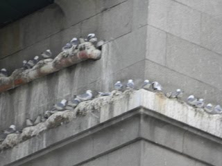
Millennium Bridge. There was a series of bridges crossing the Tyne and the iconic metal bridge, a smaller version of the Sydney Harbour Bridge, had kittiwake seabirds nesting on the edges of spars and beams. They usually nest on rock ledges on cliffs so this wasn’t so unusual for them. They were also making homes for themselves on window ledges, gutters and chimneys of nearby buildings and were making the squawking noise that resembles their name.


It wasn’t long before we were clear of the city centre still on the lovely footpath by the river and coming into Scotswood. This had been an industrial area for coal, iron, steel and ship building, now all that was gone and has been converted to a business estate and posh housing. The route followed the

Scotswood Road
to Blaydon, made famous in the Geordie song the Blaydon Races.

After Scotswood the path took a loop away from the river to cross a bridge over the A1 motorway but found the Tyne again as it went through Lemington and Newburn. There were a number of people on the route doing the walk and all of them like us heading for Heddon for the first day’s stop. A large group from the military based in Portsmouth kept passing us then we would catch up with them again when they were stopped for their many drinks and smoke breaks. As usual the last miles are the longest as you approach your destination and a long hill didn’t help but at last we reached the motorhome all safe and sound.


Tuesday  

Day 2 of the walk from Heddon to Chollerford was in complete contrast to yesterday. We were now out in the countryside and the paths were grassy or gravel over fields and through wooded sections. The guide book said that the trail mainly runs beside the ‘thundering B6318’ and people don’t like it much because of this. The B6318 was busy for a minor road but the trail for most of the way was well separated by a wall or hedges as we hiked along the farmer’s fields.

I drove to Hexham which was about 15 miles away just off the A69 Newcastle road. I got the van parked in a municipal car park in the centre of town; it cost £2 for 9 hours, not bad.The terminus was just a short walk away for the bus to Heddon. There doesn’t seem to be any logic behind bus fares, it cost £4:40 each nearly double what we paid yesterday for roughly the same distance.

At Heddon before setting out on the path we had a slight detour to see and photograph the remains of the first section of the actual wall. It was only a small piece that was left after most had been cleared for farming or houses. Leaving Heddon we did go along a pavement beside the B6318 but it was only for about a half mile then we were on grass, although we could hear the traffic it didn’t disturb us. After about 30 minutes we came to a sign post telling us that it was the site of Rudchester or Vindobala Fort but nothing remained, the stones of the fortifications had been taken for the construction of a military road by General Wade which is now the B6318.

As we strolled along there was evidence in places of the ditch built as an extra defence to the wall but not any evidence of the wall itself. At Wittledene Reservoir we had a break and sat in the bird hide for observing our feathered friends on the waters of the reservoir, but at that time of the day there weren’t many about. We did meet there a bunch of Dutch hikers going in the other direction; they weren’t very fast having taken 10 days already from the Solway. Shortly after the reservoir we arrived at Robin Hood Inn and there was a stamping point to mark our passports. From the inn to Piers gate where we had our lunch stop the path was being maintained by workmen with heavy duty lawnmowers and strimmers cutting down the grass and weeds. They work for the Northumberland Highway Department that owns the section of the trail here and maintain it.

After lunch the trail ran close to the road on a track through the fields of the farms with sheep and cattle to negotiate. As the trail passed from farm to farm and field to field there was a stile to climb and there seemed to be hundreds of them..

At Planetrees there was a stretch of about 50 metres of wall, the first we had seen since Heddon. A bridge took us over the River Tyne again and we reached Chollerford in plenty of time for the bus. We continued through the village and reached Chesters an old Roman fort and another spot for stamping our passports. The bus stop was outside the fort and we were back at the car park in Hexham and motorhome, it was a shorter drive today back to Haltwistle and the caravan site.

Wednesday

This morning; the bus, the AD122 (named after the year Hadrian ordered the Wall) we were catching was at Milecastle Inn on the other side of Haltwistle about ¼ mile from the Wall. There was a large car park beside the Inn and Moira checked with the landlord who said it was alright to park there for the day while we walked. It took 35 minutes to get to Chesters where we finished yesterday and the bus taking a detour from Once Brewed to Vondolanda a Roman fort and museum that is a bit off the trail. When we reached Chesters Roman Fort we got started straight away, which began with a long climb with the route sticking to the pavement on the B6318 but soon as we cleared the village of Walwick at Black Carts we came across today’s first section of the Wall a long stretch going up a hill with its own turret. Throughout the day we were to see lots of the Wall, some just a small pile of stones others going for hundreds of metres. Surprisingly bits were in very good condition as they had been reconstructed in the 19th century by a Newcastle town clerk, John Clayton. Other features that were highlighted by information boards were the Milecasles, a Roman mile or 1000 paces apart, with two observation turrets equally spaced between each Milecastle. The Romans were based at the Milecastles and patrolled the Wall between them. In front of the Wall was a large deep ditch which was evident along most of the walk with the path running above it a lot of the time.

It was quite easy going at this time with stiles to cross and gates to go through as we passed from one farm and field to another. This path led us to Brocolitia Roman Fort which had a car park at the side of the road with a tea and coffee van, the fort being mostly underground.  Further along the trail there were the remains of a Mithras Temple, the altar and about a foot of the walls still intact.

Shortly after leaving the temple we had a long hill to climb, not steep but steady. At the top we decided it was time for lunch and then on to Housesteads, a large Roman fort, for the stamping of our passports. The walk had been relatively flat up till now as we approached Sewingshield’s Crags it changed. There was a steep climb to the top of the crags and we got wonderful views to the north over Bromlee Lough and climbers scaling the rocky cliffs.

After Once Brewed it was more up and downs but we managed to avoid a lot of them by taking another low level path, the Roman military road, at Crag Lough, but we were up high again above the junction to Once Brewed with more rock climbers and a steep bolder strewn descent to the road.  From this junction there was more climbing and we reached the highest point on the whole route at Green Slack. There was a trig point and the height was 345 metres. The panorama from this point was the best so far with brilliant views of the rocky crags the Wall and the lake beneath.Onward it wasn’t all downhill we still up more ups and downs before reaching Milecastle 42 where the road took us down to the Inn, named after the Milecastle, and the motorhome. It had been a strenuous walk today and it was very warm, we were tired and glad to be back and that it was only a short drive back to the caravan park.


Friday  

I drove down to Milecastle Inn but this time continued down to the car park near the trail, it cost £3 to park there all day. I took some photographs of the ridge that we had come down the other day and the disused Cawfields Quarry which had been flooded and was now an attractive pond with ducks swimming about. Today we were catching the bus back to here because of the more convenient parking.
               

The going was a bit easier than yesterday and not so rugged, grassier but there was a ridge after the start up to Great Chesters Fort and some crags. We got on to a low level path and thought we had missed the main trail and climbed up to the ridge again above Walltown Quarry also disused and another pond. We had a lovely view from the top but then found that we had to go all the way down again to the path that circled round the pond.

There was another old Roman Fort and museum at Carvoran then the trail followed the huge ditch to the ruins of Thirlwall Castle, not a Roman relic but built in the 14th century, using stones from the wall, to protect inhabitants from cross border raids and cattle stealing or reiving.  From this point we crossed a railway line and the junction with the Pennine Way
. Now it was easy going as we crossed fields sometimes in the ditch and others on the mound beside it, there were long stretches of wall, some looked in very good condition but had probably been restored by John Clayton. The path skirted around the town of Gilsland and came to the remains and foundations of the Willowford Bridge over the River Irthing. The river had changed its course since then and the area was dry, a new bridge now spanned the river and had been installed when the Hadrian’s Wall Path was designed. Just after the river the guide book warned of a very steep hill and it was, when we got to the top the decision was lunch.     

The area was a Milecastle and plenty of Wall, there were lots of tourists and nearby was Birdoswald, the remains of another fort and museum, where we remembered to get our passports stamped.

From Birdoswald we had more good examples of the Wall, deep ditches, milecastles and turrets. The going was very easy now and any hills were gentle. We were making for the14:22 bus at the village of Banks and we pushed hard to make sure of catching it, the next one wasn’t until after 5:00. When we got to Banks Turret No. 52A there was a bus stop this was about ¼ mile short of where we had intended stopping but we got talking to some cyclists doing their version of the Wall and decided to take the bus from here.

 It took half an hour to get to Milecastle Inn as the bus route went in a loop round the centre of Haltwhistle. From the Inn we strolled down the road to the car park where we had left the motorhome and in 15 minutes we were back at the campsite


Saturday 3 July 2010

We had to change our plan for the walk as there were no buses tomorrow, a Sunday, to and from Bowness-on-Solway, so we decided to do that stage this morning out of sequence. We drove through Carlisle and on to Bowness. Bowness was a very small village on the Solway Firth and it was a nice clear morning giving us excellent views and photographs of Scotland on the other side of the river. It took 45 minutes to get back to Carlisle in the bus.

From the bus station we made our way down to the Sands centre on the River Eden and got our passports stamped at the sports centre close-by. The route today wasn’t very interesting as regards the Wall; there were no ruins, milecastles or turrets and only a few traces or examples of the ditches and mounds. It started running along the banks of the River Eden; the path was narrow and tended to go up and down, after the village of Grinsdale there was a nice bridge over the Sourmilk. We were hoping for a nice spot beside the river for our lunch but the path tended to run at the top of a steep bank and there was no convenient place then it left the river as it cut across a loop. When we reached the river again at the village of Beaumont which had a bench that circled round the trunk of an old oak tree in the village square, we stopped there for lunch. There was an attractive church that according to the guide book was built with stones from the Wall.

When we got going again there was a bridleway running between hedges until it met the road just before Burgh-by-Sands. This bridleway followed the line of the Wall and there were signs of the ditches and mounds. After Burgh-by-Sands the route took to the road, it was straight and boring. On our right was marsh land on the edge of the Solway Firth that was at low tide and sandy, to the left the verge rose up to a flat mound probably from the Roman activities which the path should have taken. All along the road there was warning of flooding and markers for water levels.

Notices and the guide book did alert us about the tide times but in the marsh land there were cows and sheep happily grazing so we didn’t get alarmed about any imminent danger.

This long slog went on for about 4 miles and finished when we reached Drumburgh where we moved away from the Solway and into the countryside again. The route ran down through country lanes and was more pleasant. When we reached Glasson the route again followed the mound and ditches of the Wall until it reached the Solway again at Port Carlisle. Now it was the final mile along the side of the Firth to Bowness and the finish where we got the final stamp on our passports at the King’s Arms pub. The motorhome was still safe and sound where we left it and we had a cup of tea before setting off back to Haltwistle.


Sunday  

Today was our final day of the walk; we just had to fit in the section that we missed between Bank’s Turret and Carlisle. I parked the car down at the Sand’s Centre then we walked up to the bus stop. The bus went round the villages and houses as usual and it took ¾ hour to get to our start point and today is was pouring rain.

From the turret where we stopped yesterday we walked down the road to the village of Banks then into the country. There was a couple of small parts of the Wall shortly after Banks and that was it apart for many examples of the ditches and mounds but real evidence of the actual Wall seemed to be over. So from an historical point of view there wasn’t a lot and the scenery didn’t have many attractions. We were walking mainly through farms along the edges of fields with cattle and sheep grazing. Fortunately the stiles today were the gate type so we didn’t have to scramble over the boundaries in the pouring rain. With the rain the visibility wasn’t good, according to the guide book the Pennines should have been seen but we did get glimpses of the Lake District fells. We passed through a few small villages with names relating to the Wall, for example, Walton and Oldwall. There wasn’t much to photograph today and I took the opportunity at Walton to take a snap of the pub sign at the inn, the Centurion.

At lunch time the clouds began to break and thin, the rain went off and the sun was shining again and it was just after Oldwall when we had our lunch break. From Crosby the route mostly followed the course of the Eden and after Linstock crossed the M6 motorway then picked up the cycleway on the other side of the river into Carlisle. As always when you get into a big town or city the waymarkers disappear and we took a wrong turn but fortunately Moira knew where we were and got us to the car park at the Sands and the motorhome


It had been a very enjoyable walk with plenty to see as regards the Wall and some beautiful scenery. It had worked out very well centrally situated at Haltwistle and excellent public transport which ran accurately to their time table. The caravan site was excellent with all the important facilities and reasonably priced. We would recommend this method of doing the Wall to our fellow motorhomers.


THE TRUTH ABOOT THE WAALL

It was built for the Romans, way back in the past;
They built it with stone, and they built it to last.
Quite a change for the locals from digging for coal
And it kept a large number of men off the dole.

It was the Emperor Hadrian who started it all
When he ordered the peasants to build him this waall.
Just what it was for there was neebody sure
And the reasons he gave were a little obscure.

"This waall," said the Emperor, rubbing his chin, 
"Is to stop aall the Picts and the Scots getting in; 
Aa'm used to the Geordies, Aa knaa aall their tricks, 
But Aa just cannit stomach the Scots and the Picts".

They started the Waall on the banks of the Tyne
And they tried very hard for to keep a strite line.
There were thoosands of Geordies with shovels and picks
And the rate for the job was eleven and six.

The stones for the Waall came by bogie and barrow;
They were cut from the quarries at Hebburn and Jarrow.
They floated them over the Tyne on a raft,
(Them owld fashioned Geordies could certainly graft).

They travelled to Byker with nivver a spell
But they stopped for a pint when they reached the "Bluebell".
Then on across meadow and valley and dyke 
With nivvor a murmur of trouble or stike.

Onwards they went, heading West all the time,
Still trying their best for to keep a strite line.
In summer they struggled through bracken and heather
And they plodged in the darts during inclement weather.

They laid the last stone on the second of June 
and Hadrian said, "Lads, Aa'm ower the moon, 
Aa would like you to knaa that Aa'm proud of you aall, 
And Aa thank you aall kindly for building me waall".

A big celebration was held at Carlisle;
They had a grand neet and they done it in style.
The picks and the shovels were aall put away
And the workers were given an extra week's pay.

The Picts and the Scots were a little bit vexed
And voices were raised and muscles were flexed.
But their yelling and shootin' did nee good at aall;
It takes more than taalkin' to get past a waail.

And that is the story, believe it or not,
Of how they defeated the Pict and the Scot;
How the Waall was constructed for one man's enjoyment
And the North-East was rescued from mass unemployment.

Jack Davitt


References   Hadrian’s Wall Path   Henry Stedman     published by Trailblazer